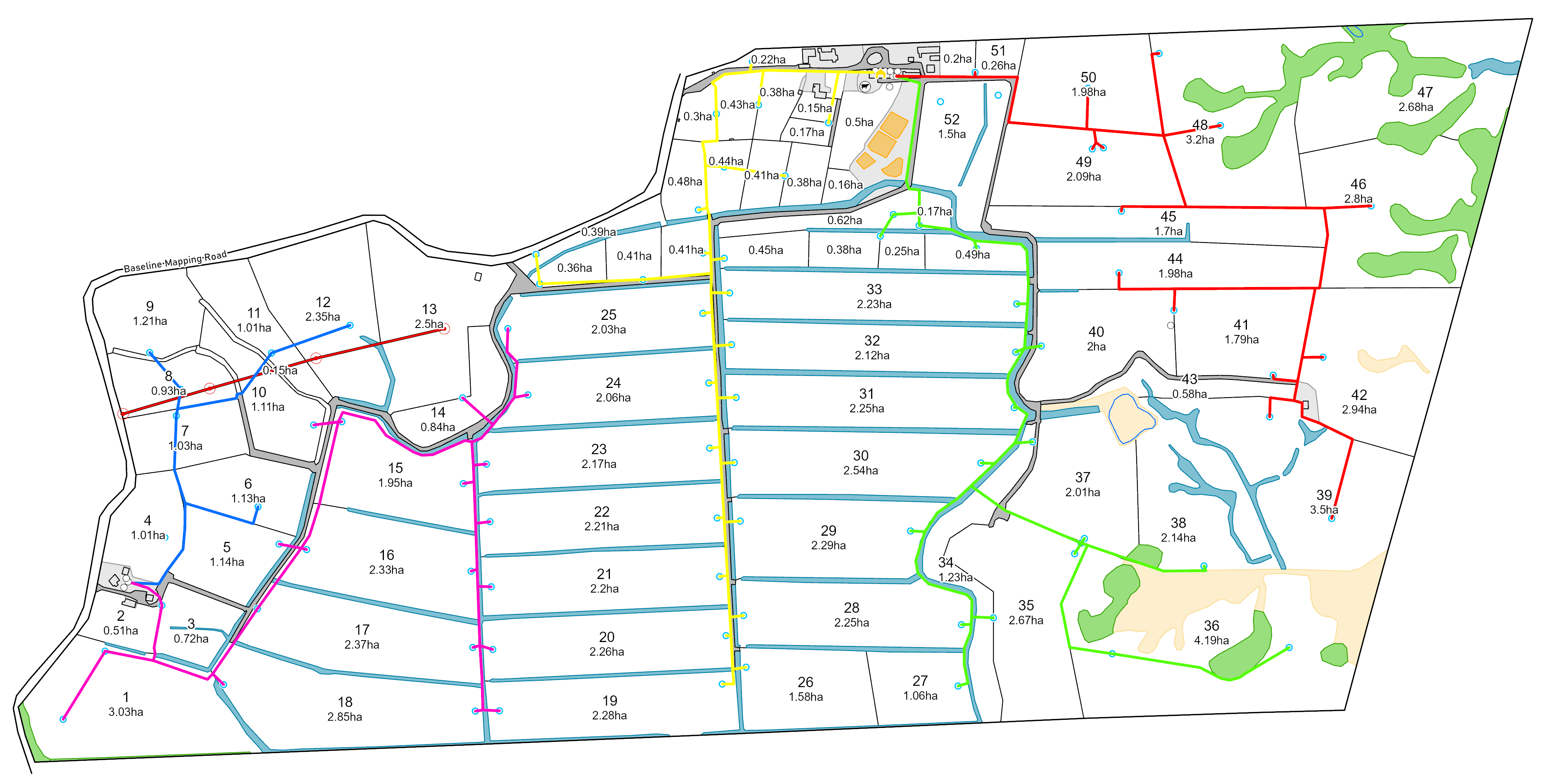
Skip to content

Services

Baseline Waterlines Non-Imagery

Farm Mapping

Clear, accurate, easy-to-read maps built from your farm’s boundaries and features. Perfect for planning, compliance, staff training, and everyday operations.
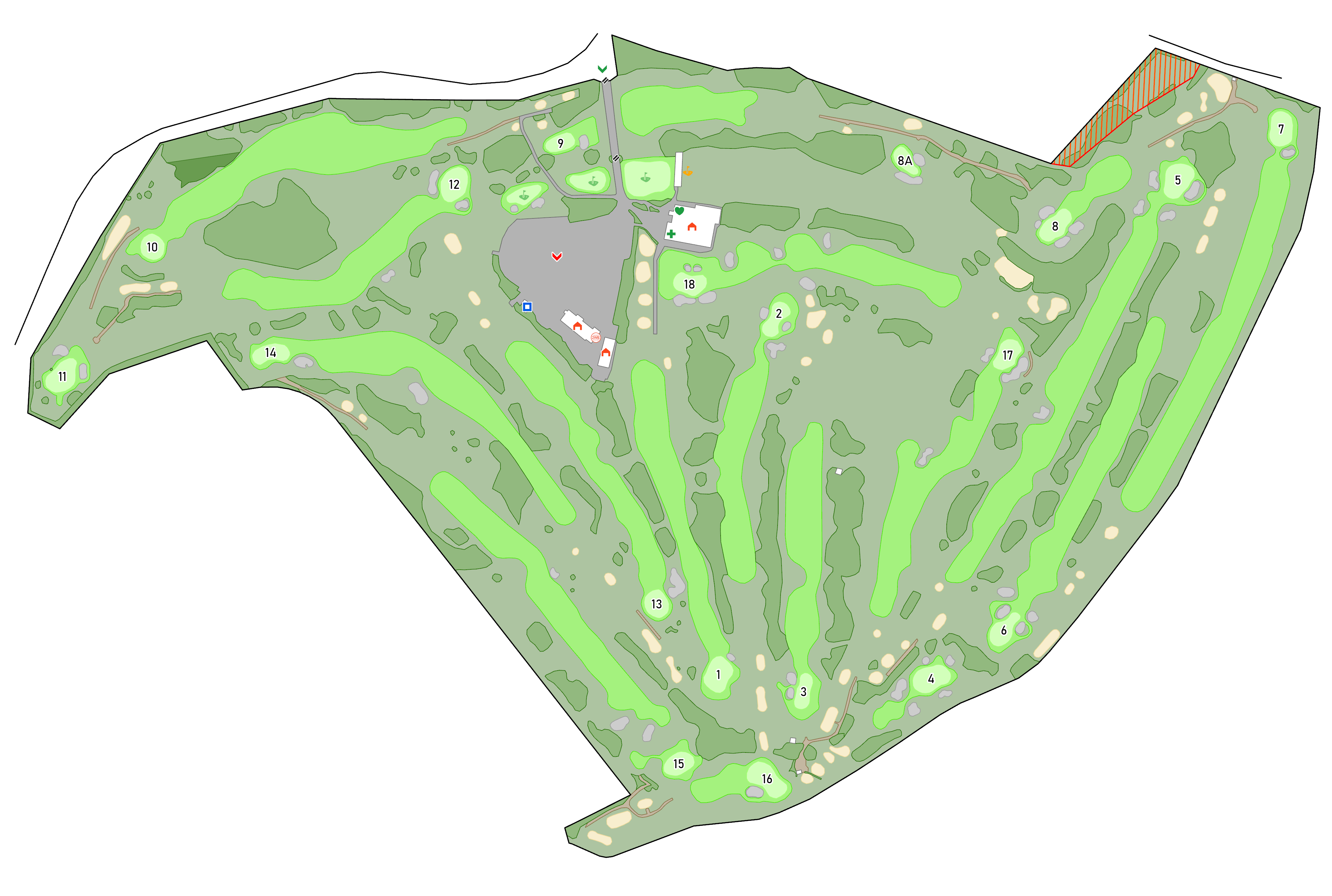
Baseline Non-Imagery-1

Golf Course Mapping

High-quality course maps for operations, planning, membership materials, and digital platforms. Tailored to the size and complexity of your course.

GIS & IT Support Services

Specialist GIS and IT services for farms, councils, consultants, and small businesses. From spatial analysis to WiFi management, Intune, and Office 365 setup.

Why Choose Baseline Mapping?

Local knowledge meets modern mapping

Maps built with practical experience, not just software.

Professional results for premium clients

Used across New Zealand and abroad.

GIS & IT expertise when you need it

Specialist support for spatial data, technical systems, and mapping workflows.

About Us:

473319782_122103173054724862_415334164231075608_n

Our Company

Created in November 2024, by husband (Joel) and wife (Ashlee). Our goal is to have no farm left behind. With the mission to reach every farm lacking an up-to-date, high-quality map and create one. Empowering farmers with precise and affordable mapping solutions to help you maximise the potential of your land. We have now expanded to map golf courses both nationally and internationally. 

Joel has six years of experience in farm mapping. Growing up in a farming family, he found his passion for helping farmers maximise their potential at an affordable price through this mahi. His wife Ashlee has a background in accounts and loves numbers. She will take care of any quote, invoice, and payment queries.